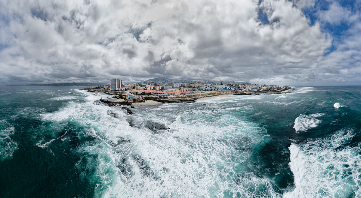
As I explain in comments below, it was not as dramatic in real life as it looks here. The panoramic view made the shoreline look small and faraway, and the crushing waves below much more prominent. Not that I am complaining :) My drone made a Jpeg panorama immediately, but the sky was blown and non-recoverable, so I had to make it manually using the original 21 DNG frames.
Statistics
Place: 2 out of 18 Avg (all users): 7.0714 Avg (participants): 6.3333 Avg (non-participants): 7.6250 Views since voting: 690 Views during voting: 62 Votes: 28 Comments: 11 Favorites: 0
Great job. The exaggerated perspective is eye catching. I always manually fly the drone to create the images and post process myself. I used the auto modes at the beginning but then wanted more control. Plus my DJI made a bunch of oddly named files in subfolders on the SD card!
The raw power of that water is so palpable in this photo. I'm dying to know what equipment was used to capture it. If a drone, it seems dangerously far off-shore, especially if the winds are as fierce as those breakers suggest!
Actually the drone was only some 100 meters from the shore. It is an illusion created by the panorama mode because it stretches the parts undneath the drone. And the wind also was not thar strong, so the drone was never in any significant danger ))
The raw power of that water is so palpable in this photo. I'm dying to know what equipment was used to capture it. If a drone, it seems dangerously far off-shore, especially if the winds are as fierce as those breakers suggest!
Amazing perspective like it's as if you are high above the city on the crest of a Tsunami like wave about to engulf the land and buildings. I presume this is a drone shot.








 Stormy day
 Add photograph to your favorites
 Add photographer to your favorites

 Photographer found comment helpful.


